
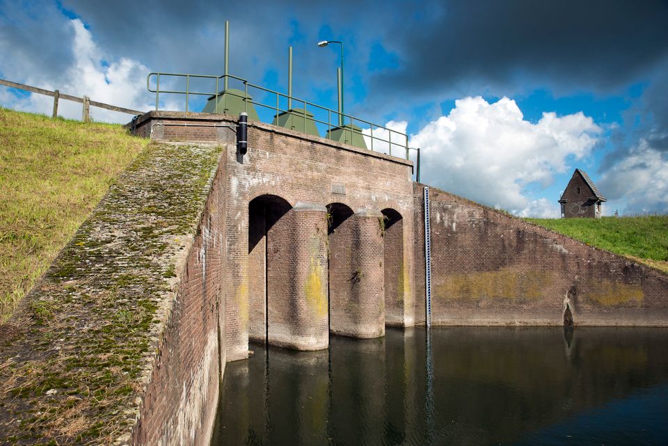
Inundation lock at Wijk bij Duurstede
In 1870, the Kromme Rijn was given a key role in the New Dutch Waterline. Back then, it took almost a month to flood the area around Utrecht. This had to be speeded up. To this end, the river was widened, its bends were straightened and locks and dams were built. Near Wijk bij Duurstede, a large inundation lock was built that made Wijk bij Duurstede the ‘tap’ with which to turn on the New Dutch Waterline. This reduced the time needed to flood the inundation areas to between 4 and 12 days. The inlet is still used daily to transport fresh water to the city of Utrecht and the river Vecht.
You may also be interested in
-
Fort bij Vechten
Fort bij VechtenAchterdijk 12
3981 HB BunnikSight, Monument, Fort, Coffee shop, Lunch, Party location or hall hire
-
Duurstede Castle
Duurstede CastleKasteel Duurstede
Langs de Wal 6
3961 AB Wijk bij DuurstedeSight, Castle or Manor, Gallery
-
Kersenmuseum (cherry museum)
Kersenmuseum (cherry museum)Landwinkel de Kersenhut
Groenewoudseweg 18
3945 BC CothenSight, Monument, Museum
-
Fort Werk aan de Korte Uitweg
Fort Werk aan de Korte UitwegLange uitweg 42
3999 WL HoutenSight, Fort, Restaurant, Lunch, Camp ground, Active and Sporty, Nature and Recreation
-
The Botanical Gardens
The Botanical GardensBudapestlaan 17
3584 CD UtrechtSight, Park/Garden, Museum, Art and Culture
-
Rietveld Schröderhuis
Rietveld SchröderhuisPrins Hendriklaan 50 a
3512XC UtrechtArchitecture, Sight, Monument, Museum, Art and Culture
-
Visitor Centre De Boswerf
Visitor Centre De BoswerfPrins Bernhardlaan 3
3708 BR ZeistVisitors' center, Sight
-
Large Pump/Vianen Town Pump
Large Pump/Vianen Town PumpStadspomp Vianen
Voorstraat 54
4132 AS VianenMonument
-
Kromme Rijn Path 29 KM OR stages of 7 KM each
Kromme Rijn Path 29 KM OR stages of 7 KM each29.0 km
Hike