odp
217 to 240 of 297 locations
-
TOP Marnemoende, IJsselstein
TOP Marnemoende, IJsselstein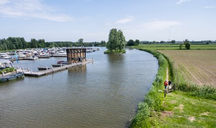
2402PG IJsselstein -
Café-Restaurant De Lage Vuursche
Café-Restaurant De Lage Vuursche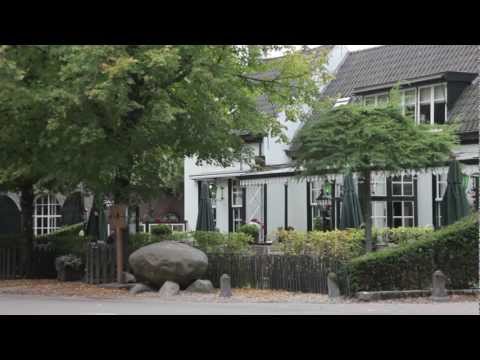
3749 AD Lage Vuursche -
Fort Nieuwersluis
Fort Nieuwersluis
3631 AA Nieuwersluis -
Fort Uithoorn
Fort Uithoorn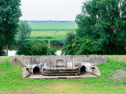
1427 AV Amstelhoek -
Brouwerij Maximus
Brouwerij Maximus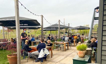
3454 NA Utrecht -
The Lekpoort
The Lekpoort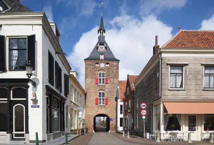
4132 AR Vianen -
Eethuys-Café De Generaal - Baarn
Eethuys-Café De Generaal - Baarn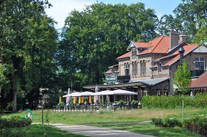
3743 JL Baarn -
Veenendaal Museum
Veenendaal Museum
3901 TP Veenendaal -
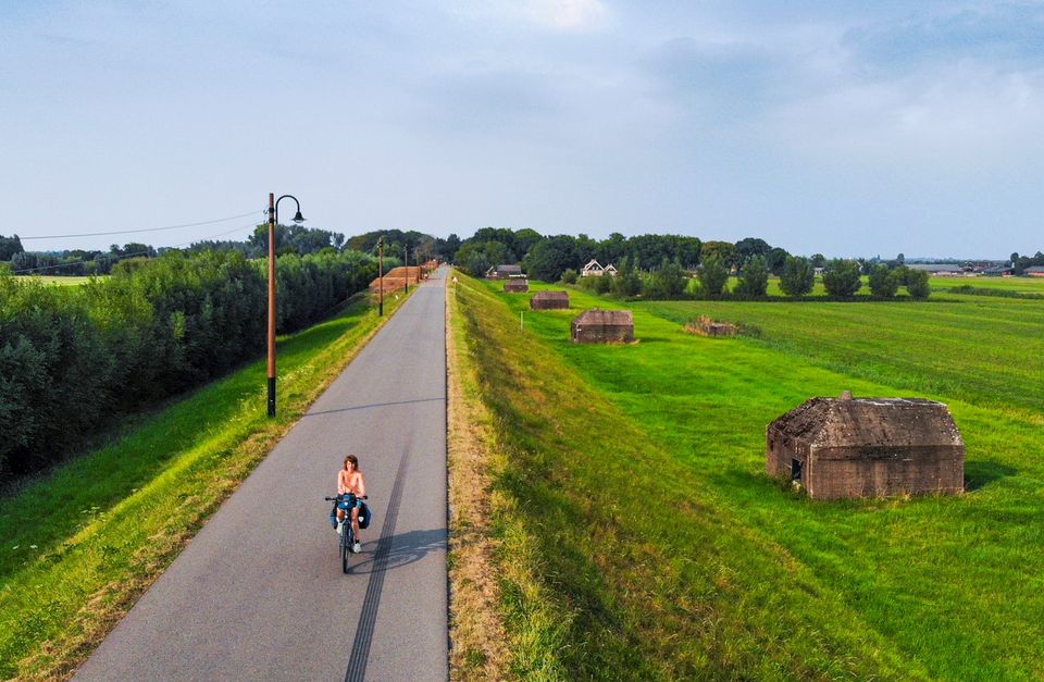
Asschatterkeerkade
Asschatterkeerkade
The Asschatterkade dates from 1745, and is one of the longest trenches of the Grebbelinie, with its length of 2500 metres. The trench from 1799 lies east of Leusden, at the edge of the flood plain. But there are also elements from more recent history which can be found.
The nine visible military bunkers, for example, were built during the mobilisation between 1939-1940. There is also a unique concrete tank barrier from this time. During the May Days of 1940, the Germans attempted in vain to break through the defences.
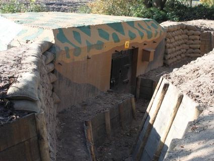
3831 JP Leusden -
-
National Military Museum
National Military Museum
3768 MX Soest -
Gagelbos
Gagelbos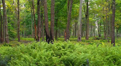
3566 MJ Utrecht -
Boundary posts
Boundary posts
In around 1875, the Ministry of War erected some 350 boundary posts along the length of the Kromme Rijn. The blue stone posts, marked with the letter O (for Oorlog, the Dutch word for war) and a number, marked the new route for transporting water to the New Dutch Waterline. The posts used to line up with plot boundaries. Many have been removed over the years, but the water board has returned 18 of them to their original location along the towpath between Werkhoven and Odijk following the construction of an environmentally friendly riverbank.
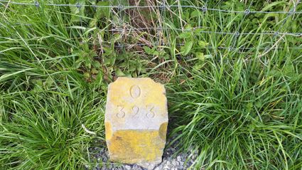
Odijk -
-
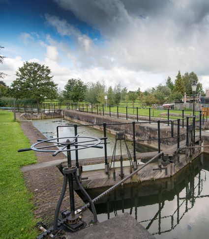
Inundation lock at Wijk bij Duurstede
Inundation lock at Wijk bij Duurstede
In 1870, the Kromme Rijn was given a key role in the New Dutch Waterline. Back then, it took almost a month to flood the area around Utrecht. This had to be speeded up. To this end, the river was widened, its bends were straightened and locks and dams were built. Near Wijk bij Duurstede, a large inundation lock was built that made Wijk bij Duurstede the ‘tap’ with which to turn on the New Dutch Waterline. This reduced the time needed to flood the inundation areas to between 4 and 12 days. The inlet is still used daily to transport fresh water to the city of Utrecht and the river Vecht.
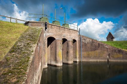
3961CH Wijk bij Duurstede -
-
Allurepark De Zeven Linden
Allurepark De Zeven Linden
3744 BC Baarn -
Diefdijk
Diefdijk
This centuries-old long dyke marks the border between the Betuwe to the east and the lowlands to the west. The purpose of the Diefdijk was to protect the lower-lying meadows whenever the higher Betuwe flooded. The dyke was reinforced in 2015 and still serves its purpose today. It was also part of the New Dutch Waterline: the area to the east of the dyke served as an inundation area. To this day, this area remains scarcely built up. Nature reserves of various sizes border the dyke on either side.

Diefdijk
4143 MG Leerdam -
-
Eemlandhoeve
Eemlandhoeve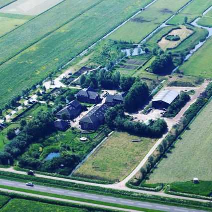
3752 LK Bunschoten-Spakenburg -
Glass studio
Glass studio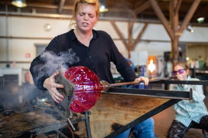
Zuidwal
4141 BE Leerdam -
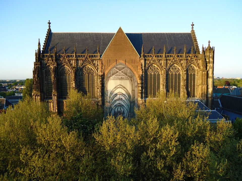
Dom Church
Dom Church
The gothic Dom Church was built as a cathedral for the bishop of Utrecht and dedicated to St. Maarten.
The interior with many lavishly decorated tombs is impressive. The Dom church draws many people daily for a guided tour or a moment of silence and peace. The free Saturday afternoon concerts (3.30 pm) have been a household word in Utrecht for over thirty years.

Domplein 0
3512 JD Utrecht -
-
Museum Spakenburg
Museum Spakenburg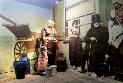
3752 AH Bunschoten-Spakenburg -
Muurhuizen (Wallhouses)
Muurhuizen (Wallhouses)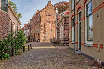
3811 Amersfoort -
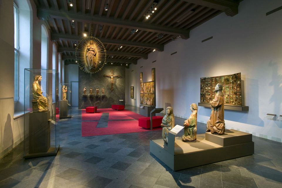
Museum Catharijneconvent
Museum Catharijneconvent
Museum Catharijneconvent shows the history of Christianity in the Netherlands through centuries-old art as well as contemporary art.
Paintings by Rembrandt, Pieter Saenredam and Jan van Scorel, relics, video art by Guido van der Werve and others, sculptures of saints, ancient manuscripts, a huge stained glass window by Marc Mulders and all there is to know about holidays such as Christmas, Easter and St Nicholas. This and more is on display in the Catharijneconvent Museum in a magnificent medieval convent. This oasis of art and culture is located in the centre and in walking distance from the Dom. The Catharijneconvent Museum tells the fascinating story of the past and present of Christianity in the Netherlands. With a collection consisting of Protestant and Catholic art and cultural objects, there is no other museum like this in the entire world.
Lange Nieuwstraat 38
3512 PH Utrecht -
-
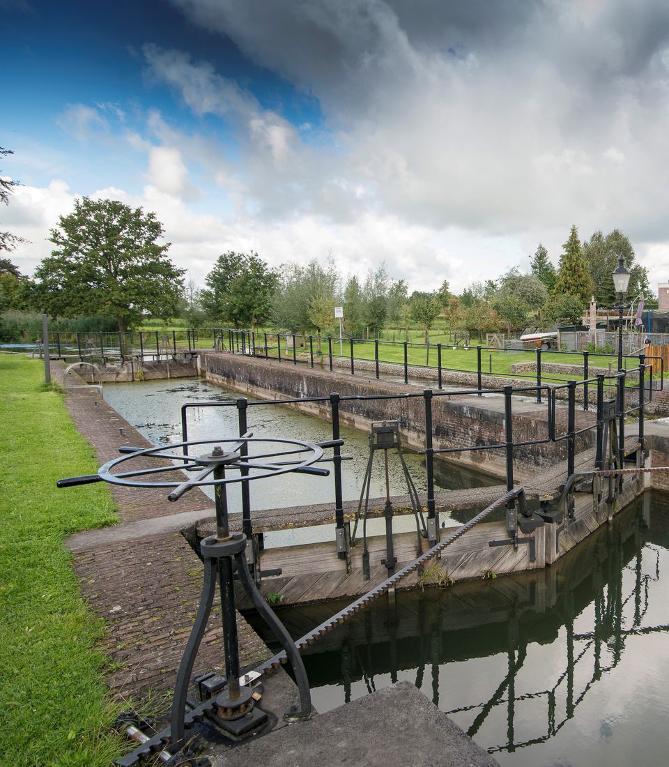
Lock at Cothen
Lock at Cothen
The water board uses the dam in the Kromme Rijn in Cothen to regulate the flow of water to and from Utrecht. The monumental lock alongside it (from 1865) was used during wartime to move ships past the dam. When the Waterline needed to be flooded, the commander of the inundation station at Wijk bij Duurstede first gave the order to raise the water level in the Kromme Rijn by closing off the lock with stop logs. Next, he ordered the stop logs to be removed so that a large body of water could flow from the open lock to Utrecht.
3945BN Cothen -
-
Landgoed Ginkelduin
Landgoed Ginkelduin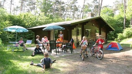
3956 KD Leersum -
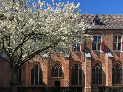
The Great Church of Wijk bij Duurstede
The Great Church of Wijk bij Duurstede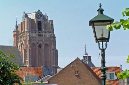
3961 BC Wijk bij Duurstede