
Canals and wharf cellars walk
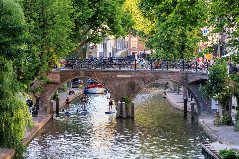
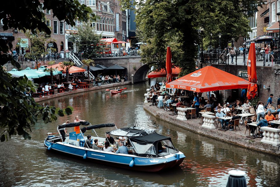
Utrecht's canals with their quays and wharf cellars are unique in the world. These remarkable structures were created in the Middle Ages on the initiative of private individuals. The transport and storage of commodities brought Utrecht tremendous prosperity. Nowadays, the canals and wharf cellars are a tourist attraction. Each canal has its own atmosphere and characteristics.
During this walk, you will cross a number of quays and follow the canals. You will get to know Utrecht in a completely different way.
Take a look


Locations on this route
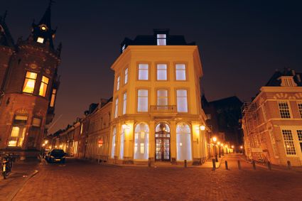
Utrecht Tourist Information 'Winkel van Utrecht'
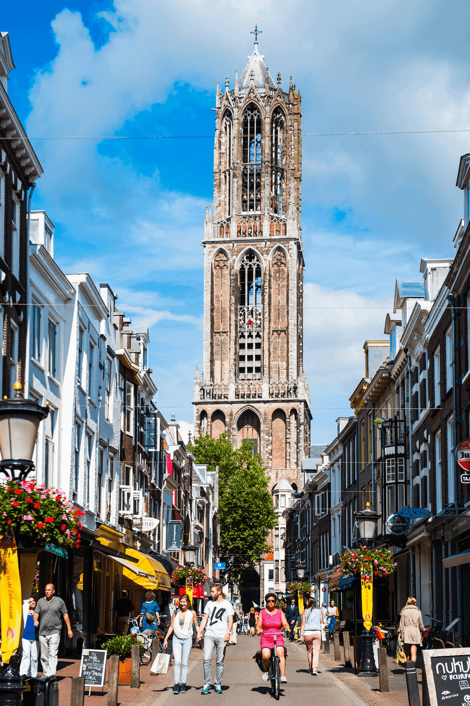
Located at the foot of the Dom Tower you will find the Utrecht Tourist Information Centre.

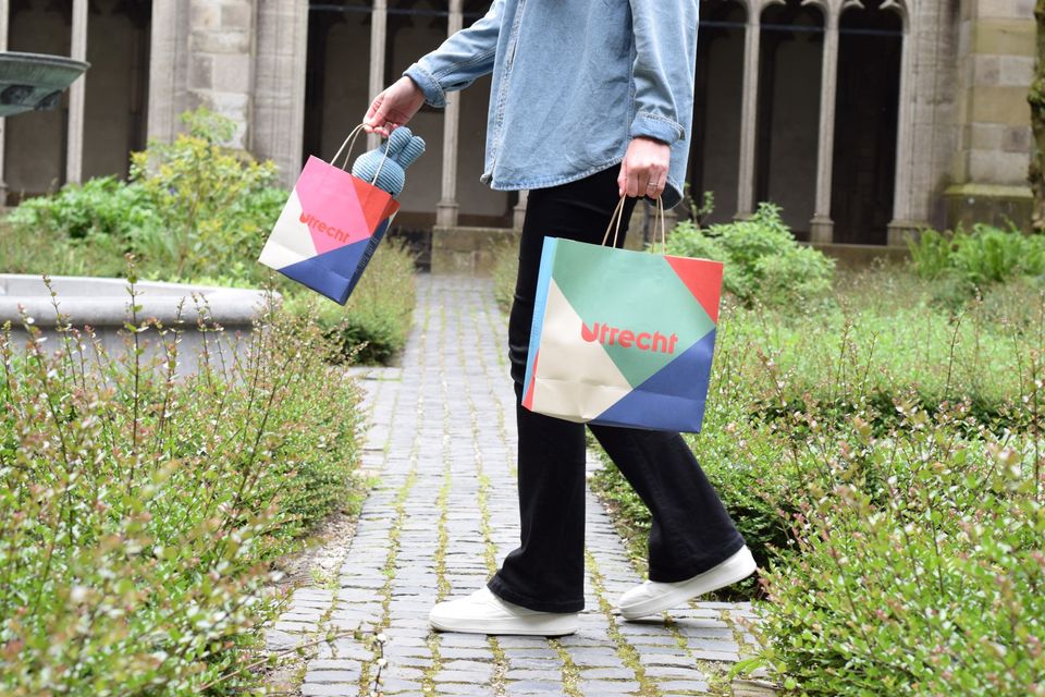
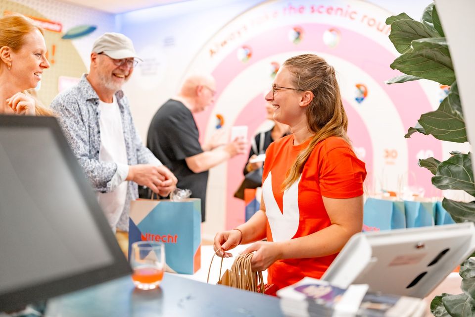
Utrecht Tourist Information 'Winkel van Utrecht'
Located at the foot of the Dom Tower you will find the Utrecht Tourist Information Centre (VVV Utrecht). Make the most of your time in Utrecht by planning your trip with help from experts! Whether you’re searching for the best accommodation, exciting excursions in Utrecht or the region, the dedicated staff of VVV Utrecht can help you with a wonderful stay. They can also help you to book tickets, toursand information about public transport in and around Utrecht.
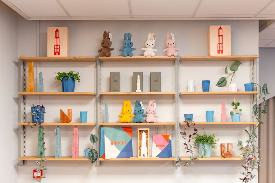
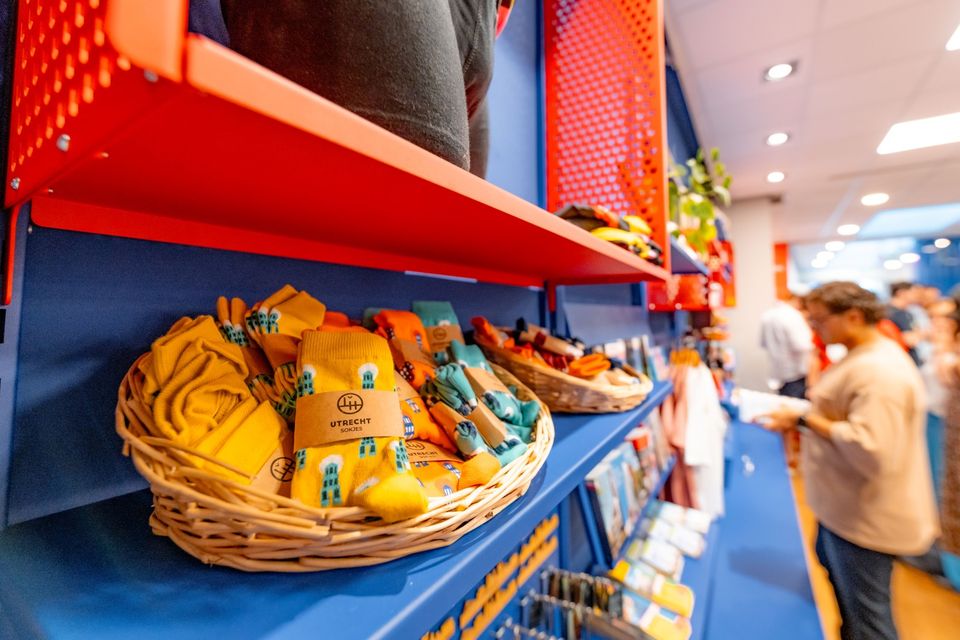
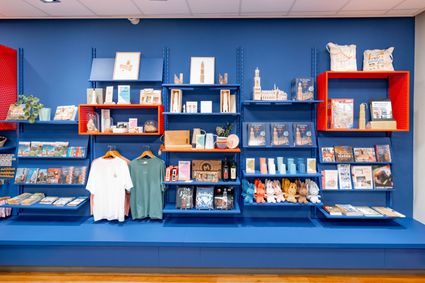
The Tourist Information Office is also the ultimate souvenir shop in Utrecht, with Holland souvenirs, typical Utrecht products and the largest selection of Miffy gifts in a special Miffy house available!
Go to the VVV Utrecht Information Centre for:
- Tourist information
- Dom Tower climbs
- Souvenirs
- Hotel bookings
- Gift vouchers
- Bicycle hire
- Walks and bicycle tours
- Guided tours
The information centre has free wireless Internet.
Public holidays:
Regular opening hours apply during public holidays, with the exception of Kings Day (27 April) during which the information centre will be closed.
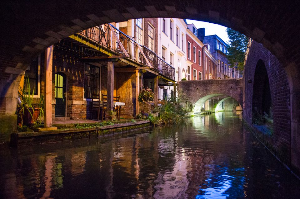
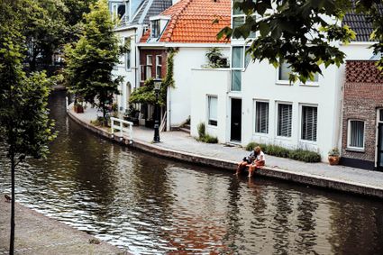
Canals and shipyards
The Utrecht canals with their wharves and wharf cellars are unique in the world.

Canals and shipyards
The Utrecht canals with their wharves and wharf cellars are unique in the world.
The 12th Century Oudegracht was built to change the course of the Oude Rijn river. Connecting the river Vecht in the north to the Vaartsche Rijn in the south, the Oudegracht was destined to become an elongated harbour. Large city castles were built along the canal and in the 13th Century, shipyards were built as second streets at water level. The deep cellars, serving as storage spaces, ran through to below the houses. Today, the canals and shipyards are home to shops, restaurants and private residences.
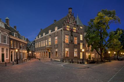
Utrecht City Hall
Utrecht City Hall is situated in the heart of the city, right on Oudegracht. The history of the city hall goes back a long way, but the oldest parts of the current building were built in the 19th century.

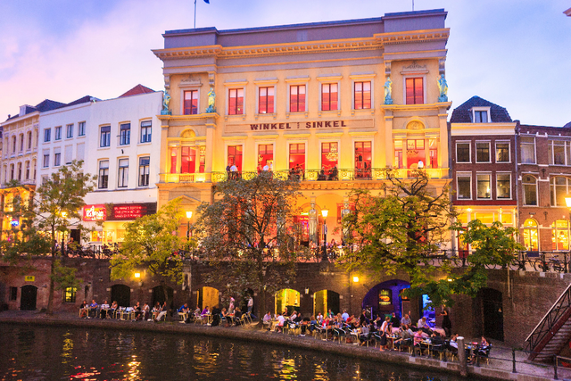
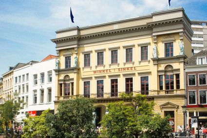
Winkel van Sinkel
The Winkel van Sinkel is a grand café and a festivalpalace in one.
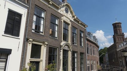
Papal house
Paushuize is the second oldest historic building located in the city centre of Utrecht and made in commence of the only Dutch Pope Adrianus VI.
Pausdam
The Pausdam is dominated by two historic buildings: The Paushuize or Pope‘s Residence and the University premises at the head of the Trans.
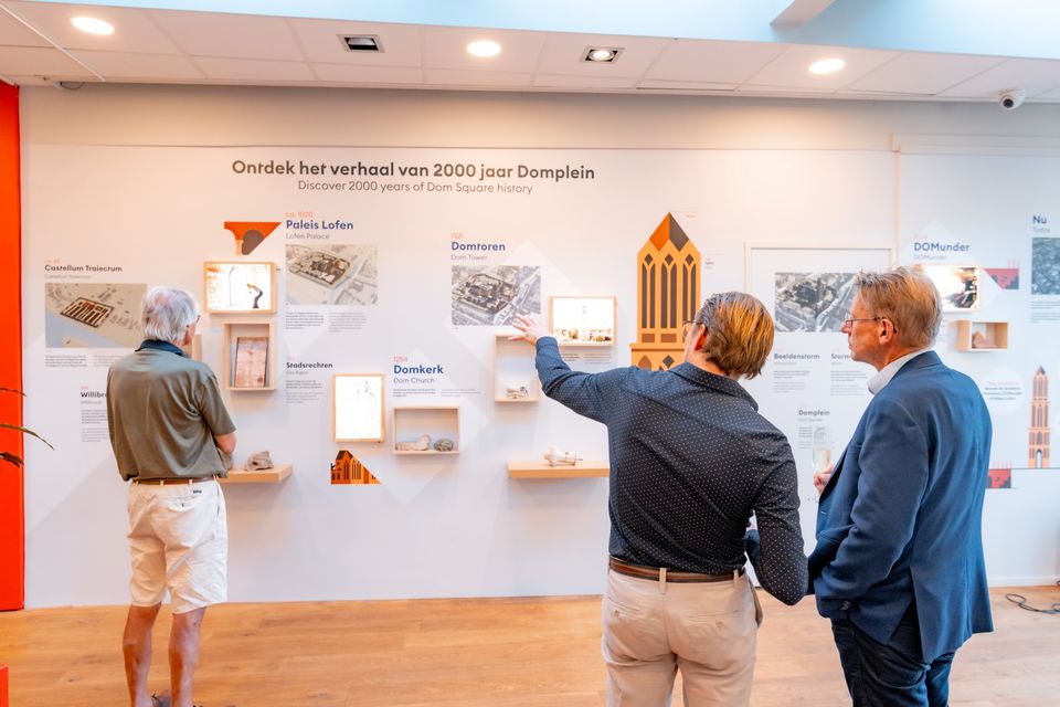
DOMunder
Discover 2000 years of history underneath the Domplein square.
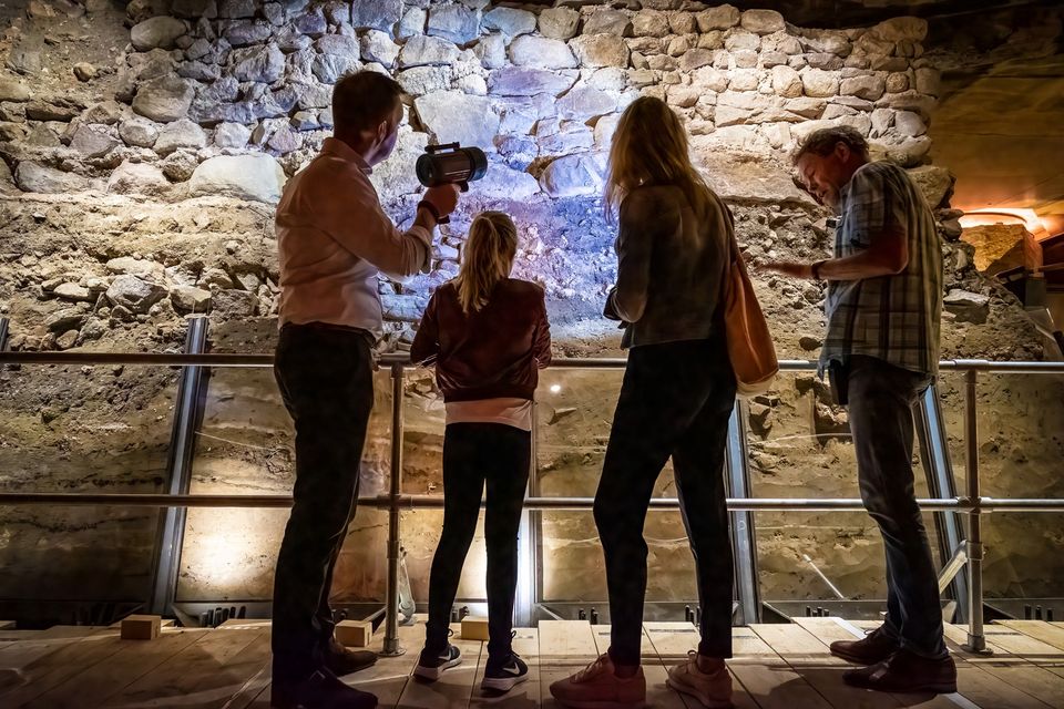
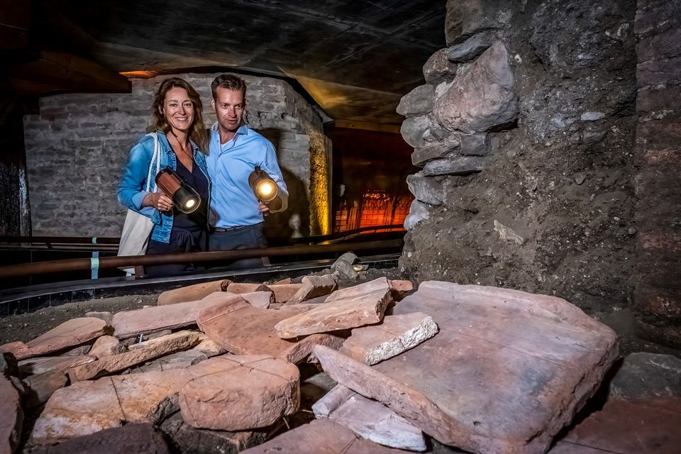
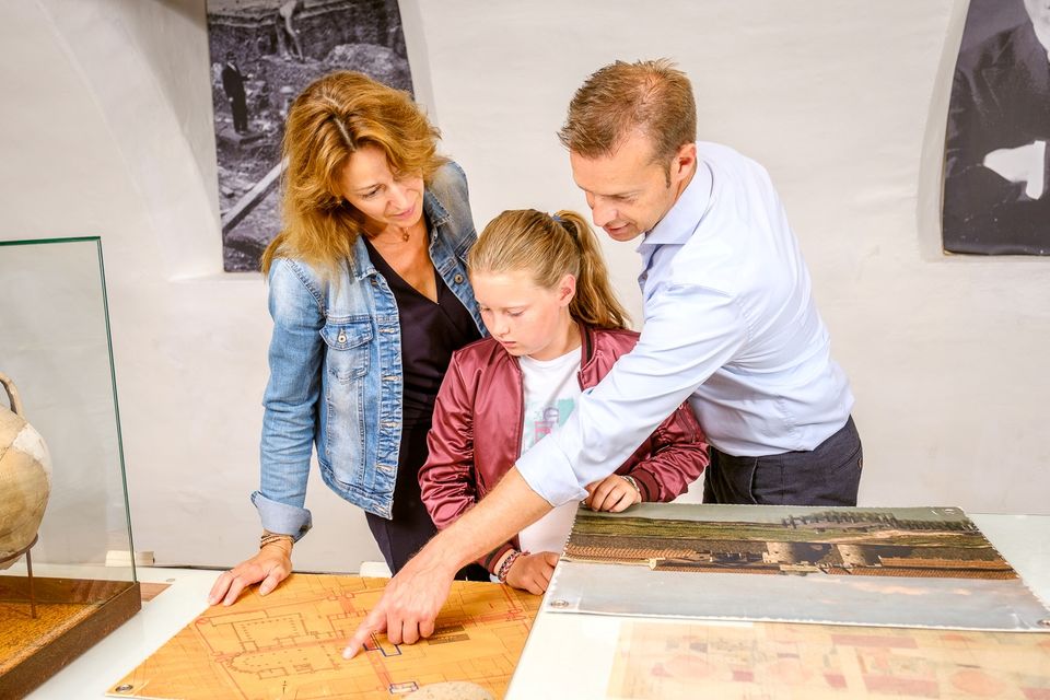
DOMunder
DOMunder uncovers the rich history of one of Utrecht's most significant locations: Domplein. Guided by an expert and equipped with your own smart flashlight, you will explore the place where the city of Utrecht was born. Go underground and discover archaeological remains and exciting stories.

Directions
Route description (self-guided walk)
- Walk straight away from the Utrecht Tourist Information Centre onto Servetstraat. At the end of Servetstraat you will arrive at the Oudegracht (‘Old Canal’), originally the mercantile canal. Goods were transported and traded by ship along this route during Utrecht's Golden Age in medieval times. Part of the Oudegracht is located in the bed of the Oude Rijn (‘Old Rhine’) and was dug in sections during the 11th and 12th centuries. Originally, the Oudegracht was directly connected with the rivers of the Rhine delta, which led to flooding and other water-related problems. The banks were raised to reduce flooding. Now both streets along the canal functioned as dikes against the frequently rising water. The construction of a lock near Wijk bij Duurstede in 1122 made it possible to control the water level of the Oude Rijn. Because that level was kept below street level, ships could no longer moor at the quays. New quays were constructed just above the water surface, and the storage cellars under the houses were extended to the waterfront. This resulted in a system of quays, quay walls and wharf cellars. The quays are open to the public.
- Turn right on the Oudegracht and walk up the Vismarkt (‘Fish Market’). The fish that was brought in via the Oudegracht was sold here on the Vismarkt and the Kalisbrug bridge starting in the Middle Ages. The bridge had ceased to serve as a fish market before World War II. However, there were still fishmongers occupying various buildings along the Vismarket. The last one left in 1970. There are a couple of replicas of the old fish stalls on the bridge. Salt is required to preserve fish. Consequently, the Zoutmarkt (‘Salt Market’) is located across from the Vismarkt on the other side of the Kalisbrug bridge.
- When you reach the end of the Vismarkt, walk up the Stadhuisbrug bridge. The Stadhuis (‘Town Hall’) has been located here since the 13th century. The addition of various buildings resulted in the complex that stands here today. The main entrance was always on the Stadhuisbrug. In 1999, restoration work was done on the town hall, and part of the building underwent major renovations. As a result, the main entrance is now located on Korte Minrebroederstraat.
- After the town hall, turn right onto the Ganzenmarkt (‘Geese Market’) and enter the tunnel. In Dutch, this type of tunnel is called a wed. It allowed heavy goods to be transported by horse and carriage to and from the lower quay. The city crane for loading and unloading was situated here until 1837. It was powered by a treadmill. This part of the Oudegracht is called the turning basin. The canal is extra wide here because this is where ships had to turn around.
- When you reach the end of the tunnel you are at the water level of the Oudegracht. Walk along the quay towards the Bezembrug (‘Broom Bridge'). Most business was conducted in the streets well into the 19th century. In Utrecht, the many bridges in particular served as a marketplace. Broom makers sold their wares on the Bezembrug on market days. The name of the bridge is engraved on both sides of the bridge.
- Walk under the bridge and, after passing underneath, pay attention to the consoles or bases of the streetlights directly next to the bridge. The broom sellers are depicted on the right. On the opposite side of the canal, you can see a witch riding a broomstick. Since the early 1950s, hundreds of streetlights along the canals have been fitted with consoles featuring a sculpture.
- Go back up to the street level using the stairs to your right. On your right is Winkel van Sinkel. Previously, it was Utrecht's very first department store; nowadays it is a restaurant. It was built in neo-Classic style between 1837 and 1839. The front of the building is supported by four caryatids, modelled on the Parthenon in Athens. The arrival of these 3-tonne cast-iron statues spelled the end of the city crane in 1837. The crane collapsed under the weight of one of the ladies.
- Using the Bezembrug bridge, cross the Oudegracht and turn right. Continue your walk on the other side of the Oudegracht and when you reach the first bridge, the Bakkerbrug, go down the stairs. The two Blankenburch mansions - small and large - are located here at the bend. The console below depicts two gentlemen arguing. The neighbourly dispute concerned a window in the house belonging to one of them. How it was resolved remains a mystery; the argument continues...
- When you reach the Jansbrug bridge, use the stairs to go back up to the street level and turn right. You have a lovely view of Kasteel Oudaen (‘Oudaen Tower House’) from the bridge. Wealthy merchants built their mansions along the Oudegracht. Huis Oudaen is a stunning example. Built sometime around 1275 by Vrederik Soudenbalch, it later came into Dirk van Houdaen's possession. From 1759 until 1965, the house served as a home for elderly men and women. It was converted into a restaurant in 1997.
- Cross the Jansbrug and turn left. At 114 Oudegracht you will find Drakenborch mansion, one of the oldest stone residences in Utrecht. Part of this house dates all the way back to 1280. The plaque is a reference to the latest renovation. In the old days, the huge canalside mansions were difficult to heat in wintertime. Consequently, people often built a small house next to the large building. Klein Drakenborch (‘Small Drakenborch’) is visible behind the large house.
- Turn right on the first street you come to and walk down Drakenburgstraat to the Neude. This square was once a marshy area. The site was raised and paved sometime around 1500. The square served as an important marketplace for centuries. Nowadays, it hosts many events and during the summer it is virtually wall-to-wall outdoor seating for the numerous cafés and restaurants on the square.
- Keep walking along the right side of the Neude, past these establishments, and enter Kintgenhaven. At the end of this short and narrow street there is a building that previously housed art cinema ‘t Hoogt. Turn right on Telingstraat and follow it until you are back on the Ganzenmarkt. Turn left on Minrebroederstraat. When you reach the end, turn left and walk towards Janskerkhof. Part of Janskerkhof was once an arm of the Oude Rijn river. When the Oudegracht was dug, this arm lost its function and was filled in.
- Turn right before Janskerkhof and then immediately turn right again onto the Drift. At the end of the Drift, the Kromme Nieuwegracht canal and the Drift meet. Both are part of the watercourse that was completed along with the Nieuwegracht in 1392. The Drift flows into the Plompetorengracht canal, which in turn joins the Singel, which was originally the Stadsbuitengracht canal that encircled the city.
- Turn left onto the Kromme Nieuwegracht. This canal, which includes a section of the Oude Rijn, served as a boundary for the chapter of Saint Peter in the 11th century. With the completion of the canal route in 1392, this bend, which was given the name Kromme Nieuwegracht, became part of the connection between the Nieuwegracht and the Drift.
- Walk along the Kromme Nieuwegracht and when you reach the second street on your left, Muntstraat, enter this street and follow it until you reach Nobelstraat. Now immediately turn right and follow Nobelstraat until you reach Lucasbrug bridge. Instead of crossing the bridge, take a right and walk down the gravel path to the water.
- Here you get a good look at the Singel or Stadsbuitengracht. After Utrecht received its charter in 1122, defences could be created using water and a city wall. That city wall was demolished in the 19th century. An elongated city park was created along the south side of the former city wall. Walk 50 metres and you will see remnants of the city wall to your right.
- Turn right at the remnants on the wall so that you are back on the Kromme Nieuwegracht. Continue walking until you reach the T-junction with Jeruzalemstraat. To your right you will see a stately building named De Truttige Tuyl. The history of the former burgomaster's home starts in the 15th century, when its core was built as a canon house within the chapter of Saint Peter. The current configuration of the building was realised around 1725.
- Continue walking along the Kromme Nieuwegracht. After 25 metres you will reach Pausdam, where you will see a huge brick house with ‘marbled’ layers of natural stone on the corner of Kromme Nieuwegracht and Achter Sint Pieter. Paushuize (‘Pope's House’) is named after Pope Adrian VI (1522-1523). He was born in Utrecht and in 1517 he commissioned this house to be built for his retirement. He never got to see it, however.
- From the Pausdambrug bridge, you can go down the stairs on the right side to the Nieuwegracht. The majority of people who used to live along the Nieuwegracht were wealthy. It continues to be a highly sought-after residential area. The university and the church had many offices here, too. Unlike on the Oudegracht, the wharf cellars here were built for private use. Many of the handsome buildings still have a medieval residential nucleus.
- Walk along the water and you will see a house on your right that has a statue of Atlas on top of it. Here you will see a streetlight console with a mythological theme. Daedalus and Icarus during their flight from Crete. Icarus flew too close to the sun. His wax wings melted and he plunged into the sea and drowned. Continue walking until you reach a set of stairs at the Paulusbrug bridge. Take these stairs back up to the street level and enter Hamburgerstraat. When you reach the end of the street, turn right onto the Oudegracht. Continue walking until the Oudegracht turns into Donkere Gaard and then Lichte Gaard.
- From Lichte Gaard, take in the view across the Oudegracht. This section of the canal is also referred to as ‘Little Venice’ because of the visible arches along the back of the houses on the Lijnmarkt. The names Lichte Gaard and Donkere Gaard refer to the boomgaard or orchard that belonged to the bishop's palace that once stood here.
- Continue walking to the Maartensbrug bridge, the oldest stone bridge in Utrecht. It is named after Saint Martin, the patron saint of the city of Utrecht since the year 700. The ships with building materials for the Dom were unloaded under the small arch. Meanwhile, the large arch remained open for regular shipping traffic. You have now reached the end of the walk.
Attributes
