Disaster year route
Shoreline route
The water is your constant companion during along this cycling route. The Oude Rijn (Old Rhine), between Woerden and Bodegraven, is the largest river along the way, but you'll also encounter some smaller ones, such as the De Meije and De Geer rivers. Other bodies of water include the lakes known as the Nieuwkoopse Plassen and an ancient canal called the Kameriksche Wetering. With all that water, the views along this route are wonderful!
The Old Dutch Water Line
The Old Dutch Water Line (Oude Hollandse Waterlinie), water-based defences, are an important aspect of this region. This really comes to the fore in such places as Woerden, where the old fortifications are still very prominent. You will be cycling along various dykes, which were intentionally breached in the 17th century to stop the Spanish army with water.
Locations on this route

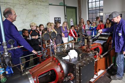
Stoomgemaal Teijlingens Kamerik
- 28
- 67
- 33
- 94
- 93
- 88
- 57
- 22
- 71
Attributes
