odp
193 to 216 of 302 locations
-
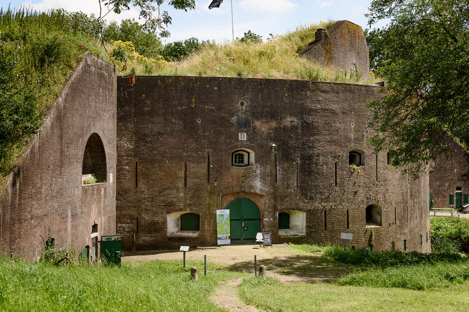
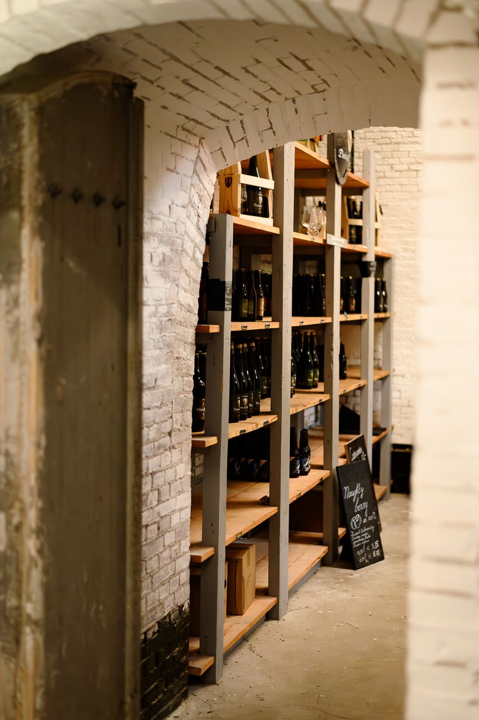
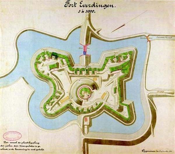
Fort Everdingen
Fort Everdingen
Anyone who delves into the history of the Vijfheerenlanden will soon discover that the now very quiet and peaceful area has a history filled with clashing weapons. Destroyed towns and castles, plundering and domestic (and foreign) wars: every town and village has its own story to tell. Everdingen was put on the Dutch military map in the 19th Century as part of the New Dutch Water Line.
The New Dutch Water Line ran from the former Zuiderzee near Muiden to the Biesbosch near Werkendam and consisted of a variety of defences and inundation fields (areas that could be placed underwater). Fort Everdingen was built between 1842 and 1847 and, together with Fort Honswijk, formed the Lek access on the other side of the Lek. The surrounding land could be flooded using inundation locks. The fort itself was walled and well defended by a variety of casemates. The new Dutch Water Line was prepared 3 times. At the end of World War II, German forces used the line as a defence against the advancing Allies. Fort Everdingen lost its defensive function after the war. The military Explosive Ordinance Disposal service used the fort until 2014. It’s now home to the German & Lauret brewery, which uses the special water filtering system in their brewery. It’s also an over-wintering place for many bats.
Further reading: Batestein Castle, Hagestein Castle, Vianen Castle, Brederode statue, Everdingen village centre, Vianen water tower.
4121 KK Everdingen -
-
Schaapskooi Heidestein
Schaapskooi Heidestein
Hoog Kanje 186
3708 XA Zeist -
Stayokay Utrecht Centrum
Stayokay Utrecht Centrum
3512 AD Utrecht -
Vechtstreekmuseum Maarssen
Vechtstreekmuseum Maarssen
Diependaalsedijk 19
3601 GH MAARSSEN -
Fort bij Vechten - Waterline Museum
Fort bij Vechten - Waterline Museum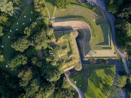
Achterdijk 2
Bunnik -
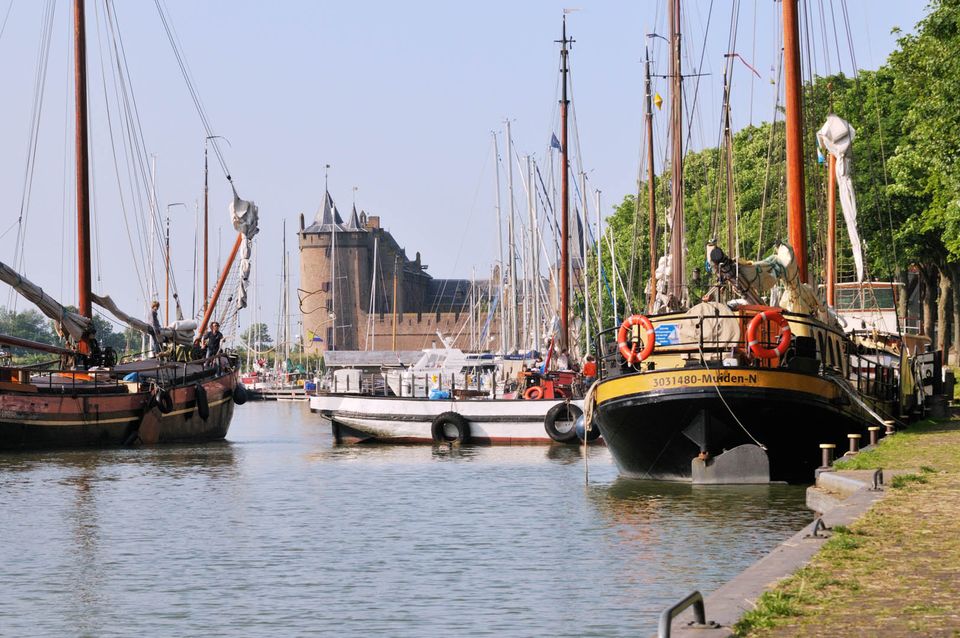
Muiden
Muiden
The best way to experience the convivial fortified city of Muiden is to take a stroll by the harbour with its many traditional sailing boats or to settle down at an outdoor café with a view of the Groote Zeesluis. Alternatively, you can explore the fort island of Pampus or visit the centuries-old Amsterdam Castle Muiderslot. Along with Naarden and Weesp, the fortified city of Muiden played an important role. Muiden closed off the Zeedijk dyke and protected the sea and inundation locks of the Vecht. Fort C, also popularly known as ‘the Muizenfort’, has a small museum about the New Dutch Waterline and the Defence Line of Amsterdam.

Herengracht
1398 AA Muiden -
-
Leersumse Veld
Leersumse Veld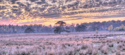
3956 KW LEERSUM -
Fort Vreeswijk
Fort Vreeswijk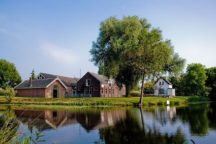
3433 ZZ Nieuwegein -
Wiel van Bassa
Wiel van Bassa
Diefdijk -
TOP trainstation Driebergen-Zeist
TOP trainstation Driebergen-Zeist
Stationsplein, Driebergen
3972 NG Driebergen Rijsenburg -
Tabaksschuur Amerongen
Tabaksschuur Amerongen
3958 ET Amerongen -
TOP Tea Garden Eemnes
TOP Tea Garden Eemnes
3755 PD Eemnes -
Spakenburg Harbour Museum
Spakenburg Harbour Museum
The Old Harbour, also known as the Harbour Museum, dates back to the 13th century. This harbour was built for the ships operated by the Zuiderzee fishermen.
Tap into the history of the fishing village of Spakenburg. Pay a visit to the museum harbour, where culture and traditions come together. Here you’ll find the oldest shipyard in the Netherlands where shipwrights are still hard at work every day, maintaining the world’s biggest fleet of ‘botters’, a special type of wooden, flat-bottomed fishing boat.
In the port of Spakenburg, you'll experience both culture and tradition. The jewel of Spakenburg's port – a museum in its own right – is the oldest shipyard in the Netherlands. From the port, you can see the shipbuilders at work. One-third of the entire Dutch fleet is moored at Spakenburg and you are welcome to come aboard!.
You can enjoy a one-hour sailing trip on a botter while listening to stories from the past, as the skipper lets you relax on the water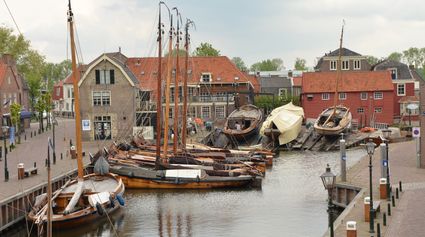
3752 AH Bunschoten-Spakenburg -
-
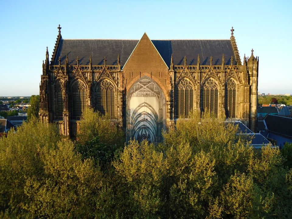
Dom Church
Dom Church
The gothic Dom Church was built as a cathedral for the bishop of Utrecht and dedicated to St. Maarten.
The interior with many lavishly decorated tombs is impressive. The Dom church draws many people daily for a guided tour or a moment of silence and peace. The free Saturday afternoon concerts (3.30 pm) have been a household word in Utrecht for over thirty years.

Domplein 0
3512 JD Utrecht -
-
TOP Museum Spakenburg
TOP Museum Spakenburg
Spakenburg -
Tobacco Cultivation Museum
Tobacco Cultivation Museum
Burg. Jhr. H. v.d. Boschstraat 46
3958 CD Amerongen -
Dagwinkel Aloys Hageman
Dagwinkel Aloys Hageman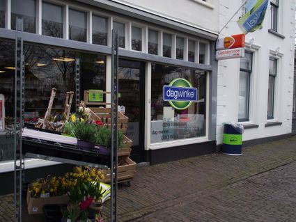
Voorstraat 15
3633 BB Vreeland -
Mill de Hoop
Mill de Hoop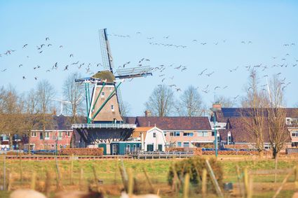
3752 CL Bunschoten-Spakenburg -
Cunera Hill
Cunera Hill
3911 AC Rhenen -
Geertje’s Hoeve
Geertje’s Hoeve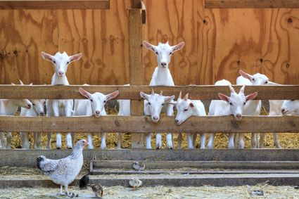
Thematerweg 5
3455 SM Utrecht -
Grebbe Line Visitor's Centre
Grebbe Line Visitor's Centre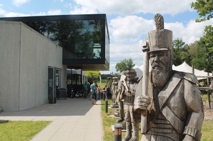
Buursteeg 2
3927EJ Renswoude -
De Vriendschap windmill
De Vriendschap windmill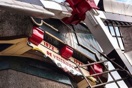
Nieuweweg 109
3905 LJ Veenendaal -
Muurhuizen (Wallhouses)
Muurhuizen (Wallhouses)
3811 Amersfoort -
Stoomgemaal Teijlingens Kamerik
Stoomgemaal Teijlingens Kamerik
3471 GC Kamerik