
Past locks and forts
Everywhere are forts, trenches, dykes, sluices, canals, casemates and group shelters to surprise you. Together these elements form an ingenious system that protected the Netherlands from hostile troops. Inundating the countryside with fifty centimetres of water made it impassable for soldiers, while still too shallow to use boats. Care to cycle through this utterly Dutch defence system from the 19th and 20th century?
Take a look

Locations on this route
Start point:
TOP Stadshaven Wijk bij DuurstedeHavenweg 1
3961 MA Wijk bij Duurstede
Navigate to starting point
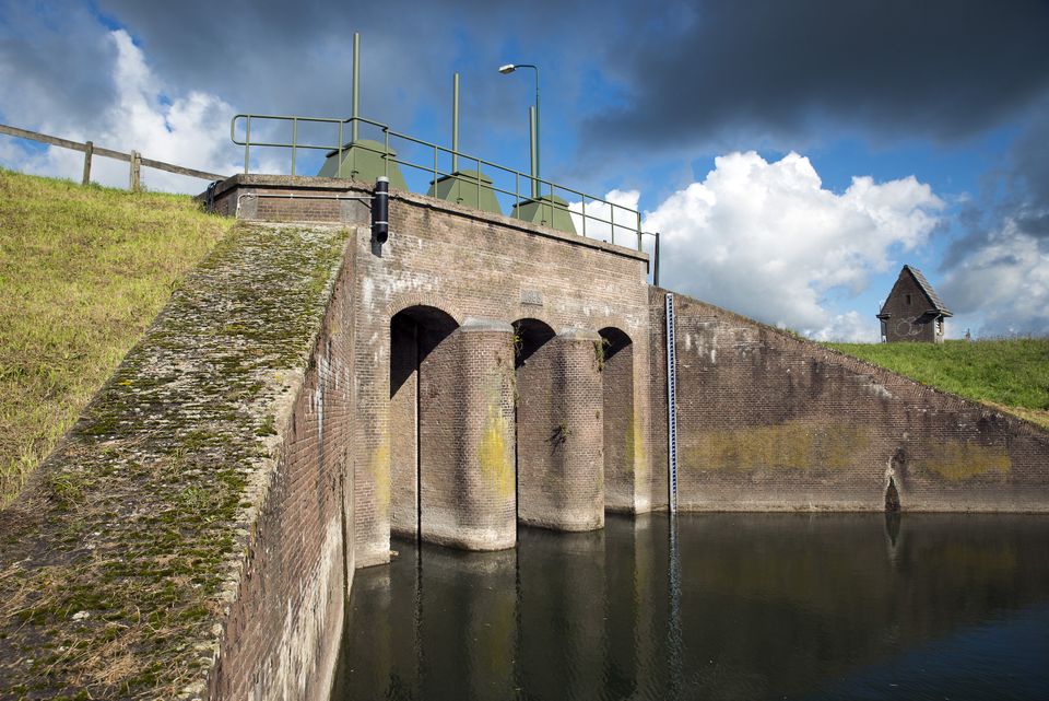
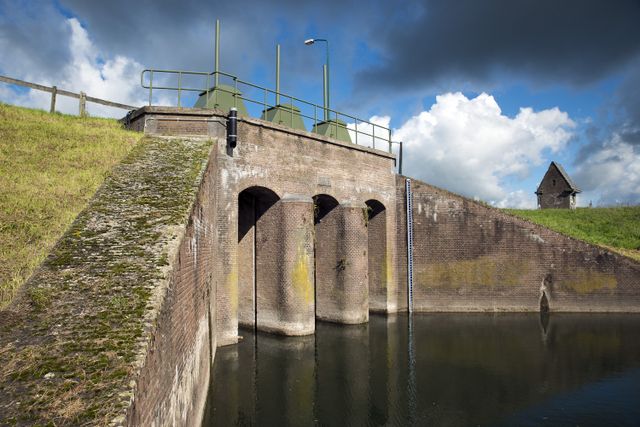
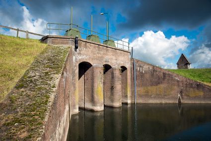
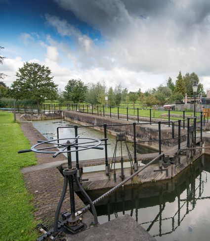
Inundation lock at Wijk bij Duurstede
In 1870, the Kromme Rijn was given a key role in the New Dutch Waterline. Back then, it took almost a month to flood the area around Utrecht. This had to be speeded up. To this end, the river wa...

Inundation lock at Wijk bij Duurstede
In 1870, the Kromme Rijn was given a key role in the New Dutch Waterline. Back then, it took almost a month to flood the area around Utrecht. This had to be speeded up. To this end, the river was widened, its bends were straightened and locks and dams were built. Near Wijk bij Duurstede, a large inundation lock was built that made Wijk bij Duurstede the ‘tap’ with which to turn on the New Dutch Waterline. This reduced the time needed to flood the inundation areas to between 4 and 12 days. The inlet is still used daily to transport fresh water to the city of Utrecht and the river Vecht.
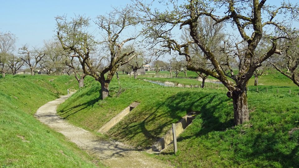
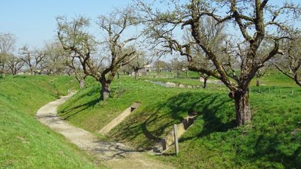
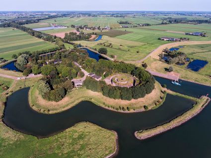
Fort Werk aan de Groeneweg
Walking through the historic trenches of Werk aan de Groeneweg is like a walk back in time. The defence structure still has its original configuration.
Fort Werk aan de Groeneweg
Walking through the historic trenches of Werk aan de Groeneweg is like a walk back in time. The defence structure still has its original configuration. The infantry set-up in World War One consisted of a double trench with earthen walls, 55 group shelters and lovely fruit trees.
The grounds are a fantastic playground for children. You can have a great time here roaming around, crawling through a trench, playing hide and seek and participating in an exciting search and experience walk of about 2 km, with soldier Vendrik as your guide.
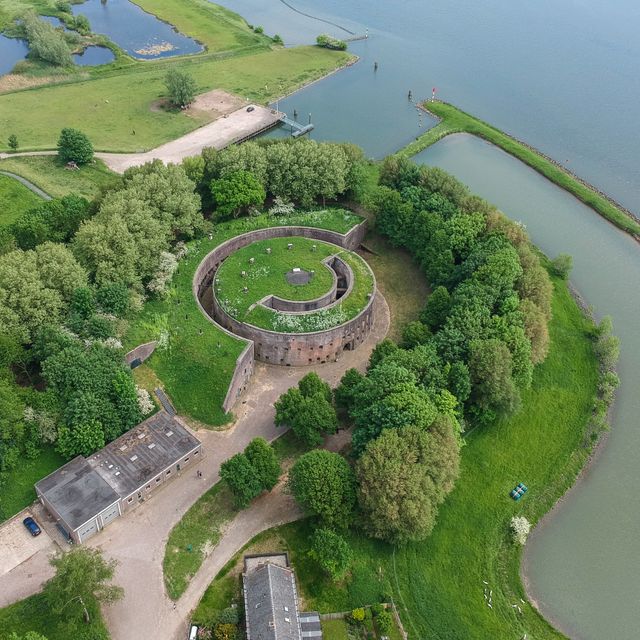
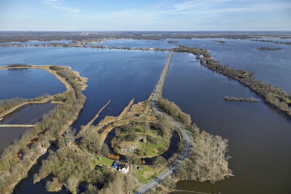
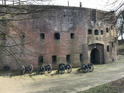
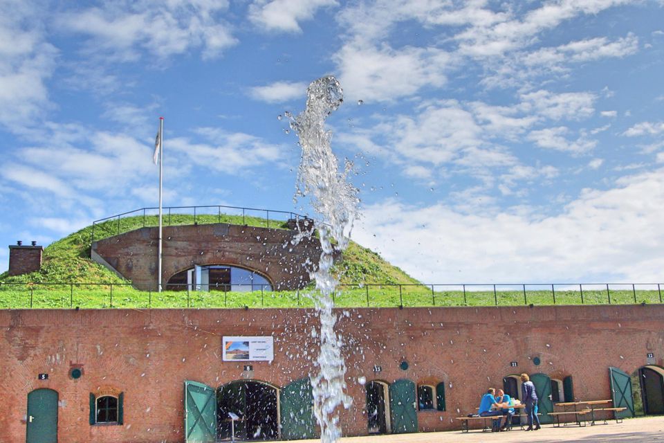
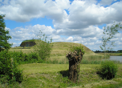
Fort Honswijk
Fort Honswijk, situated on the Lek River, is one of the most prominent forts of the New Dutch Waterline. Fort Honswijk's tower (built between 1841 and 1848) is the oldest and largest in the Waterlinie and possesses singular architectural beauty.

Fort Honswijk
Fort Honswijk, situated on the Lek River, is one of the most prominent forts of the New Dutch Waterline. Fort Honswijk's tower (built between 1841 and 1848) is the oldest and largest in the Waterlinie and possesses singular architectural beauty. Fort Honswijk was designed to stop the enemy from crossing the Lekdijk dike and to close off the Lek River in cooperation with Fort Everdingen on the opposite banks of the Lek.
Fort Lunet aan de Snel
Somewhat hidden in the woods along Gedekte Gemeenschapsweg between Fort Honswijk and Werk aan de Korte Uitweg is the small but atmospheric Lunet aan de Snel. The earthen rampart allowed defender...
Fort Lunet aan de Snel
Somewhat hidden in the woods along Gedekte Gemeenschapsweg between Fort Honswijk and Werk aan de Korte Uitweg is the small but atmospheric Lunet aan de Snel. The earthen rampart allowed defenders to repel an attack on Fort Honswijk from the north-east. In addition, its guns covered parts of the Lekdijk – something that could not be achieved from Fort Honswijk.
These days, the fort houses an exhibition that illustrates the key role that water plays in our community and its unique properties.

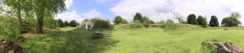
Blokhoven inundation area
The Blokhoven polder flood plain is situated behind the Achterdijk in Schalkwijk. During heavy rainfall, it can collect up to 23,000 m3 of water to prevent Schalkwijk from being flooded. This vo...
Blokhoven inundation area
The Blokhoven polder flood plain is situated behind the Achterdijk in Schalkwijk. During heavy rainfall, it can collect up to 23,000 m3 of water to prevent Schalkwijk from being flooded. This volume is equivalent to around 10 Olympic swimming pools. The area is at the heart of the New Dutch Waterline. In the summer, the plain is flooded twice a month to illustrate the inundation principle for visitors. If heavy or prolonged rainfall is forecast, the water board may decide to forego the inundation, as the plain will be needed to collect excess water.

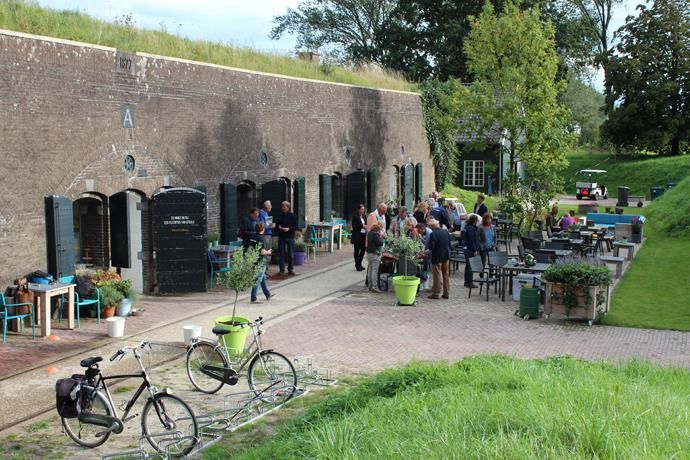
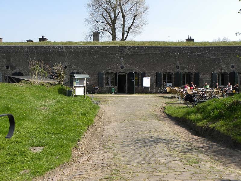
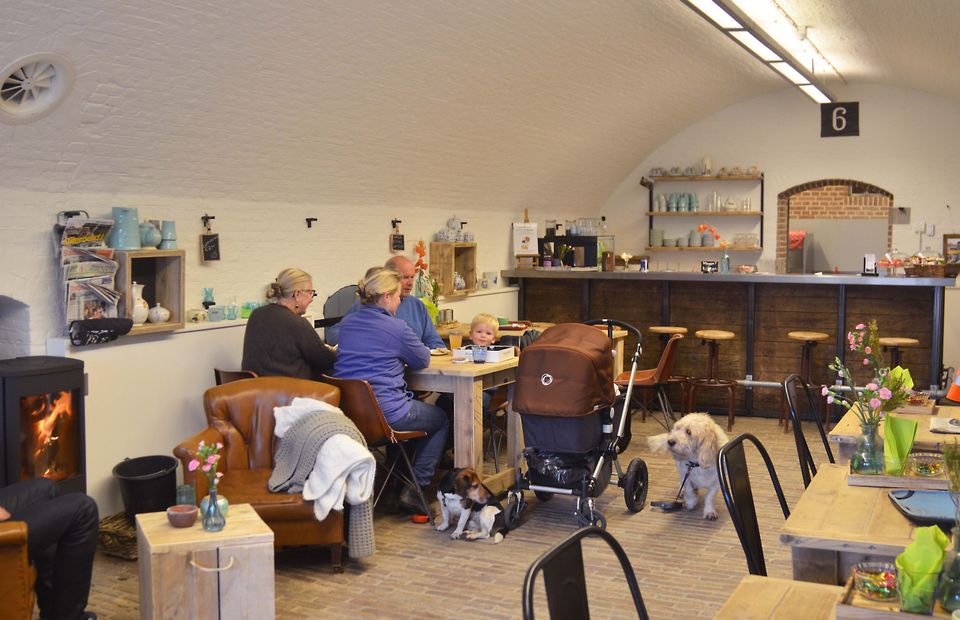
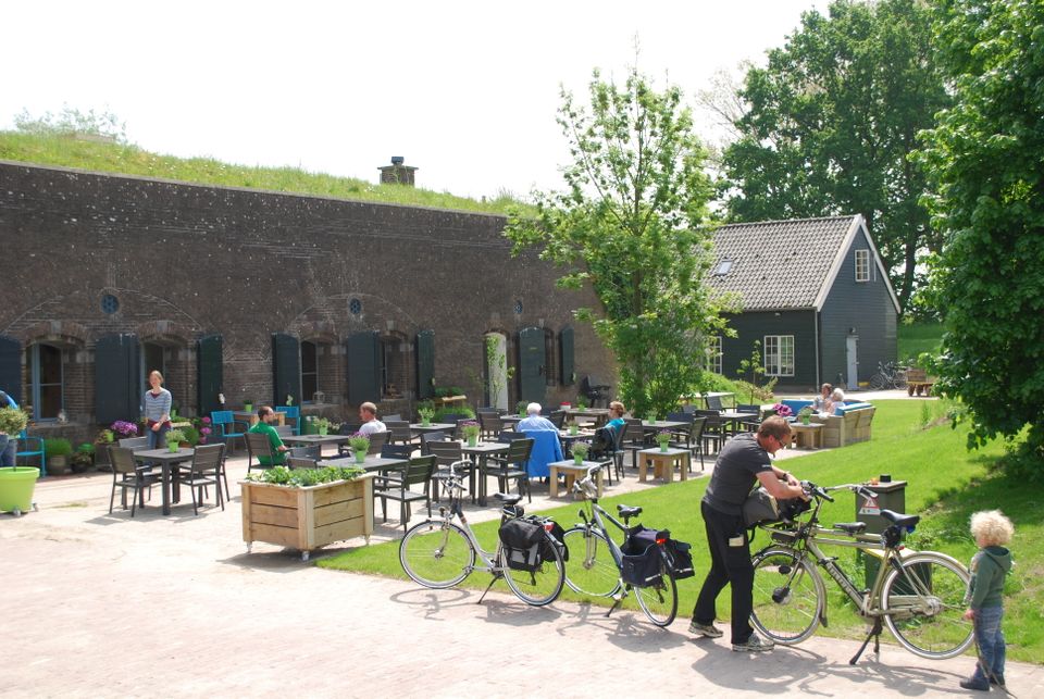
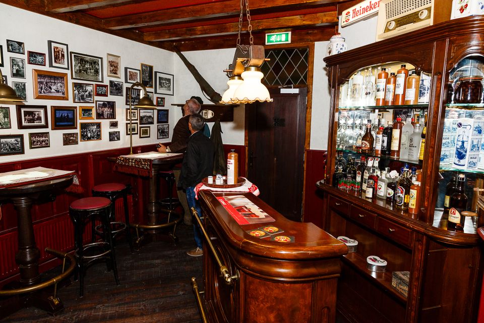
Fort Werk aan de Korte Uitweg
Fort Werk aan de Korte Uitweg (Fort WKU) is located near the Lek River on the island of Schalkwijk. Here, where the kingfisher swoops over the water and you can hear the grass rustling, you will find a tearoom and a designated Natuurkampeerterrein.
Fort Werk aan de Korte Uitweg
Fort Werk aan de Korte Uitweg (Fort WKU) is located near the Lek River on the island of Schalkwijk. Here, where the kingfisher swoops over the water and you can hear the grass rustling, you will find a tearoom and a designated Natuurkampeerterrein, or Natural Campsite.
There is lots to do in and around the fort. Have a coffee or lunch after a bike ride or a hike, or enjoy a 'green' holiday on the Natural Campsite, where you can spend the night in an honest-to-goodness fort cabin. Hold a business meeting or a drinks reception or attend a culinary workshop. Let yourself be surprised at this unique location. A variety of fun activities are organised throughout the year.

Werk aan de Waalse Wetering
This defence work was built in 1875–1878 and comprises a bomb-proof outbuilding and a guardhouse. In emergencies, it could harbour as many as 95 men. The fort is freely accessible...

Werk aan de Waalse Wetering
This defence work was built in 1875–1878 and comprises a bomb-proof outbuilding and a guardhouse.
In emergencies, it could harbour as many as 95 men.
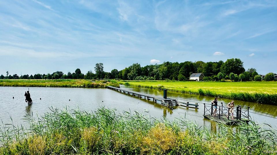
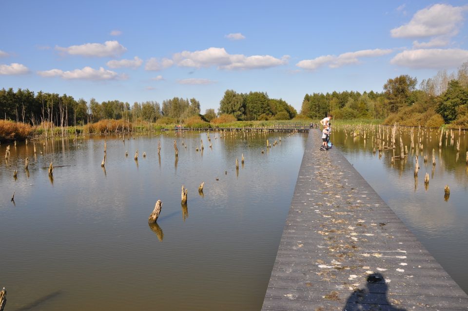
The fort is freely accessible and boasts uninterrupted views of the island of Schalkwijk. The Verdronken Bos (drowned forest), where a wooden walkway takes you across the water, is a short walk away.

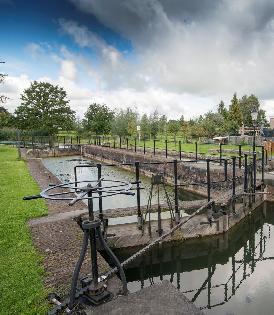
Lock at Cothen
The water board uses the dam in the Kromme Rijn in Cothen to regulate the flow of water to and from Utrecht. The monumental lock alongside it (from 1865) was used during wartime to move ships pa...
Lock at Cothen
The water board uses the dam in the Kromme Rijn in Cothen to regulate the flow of water to and from Utrecht. The monumental lock alongside it (from 1865) was used during wartime to move ships past the dam. When the Waterline needed to be flooded, the commander of the inundation station at Wijk bij Duurstede first gave the order to raise the water level in the Kromme Rijn by closing off the lock with stop logs. Next, he ordered the stop logs to be removed so that a large body of water could flow from the open lock to Utrecht.
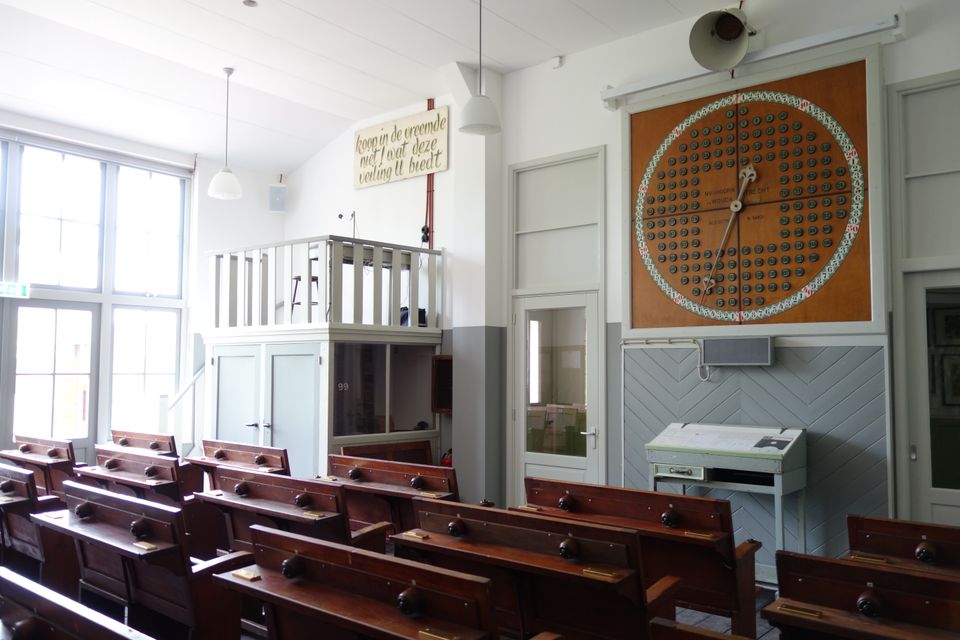
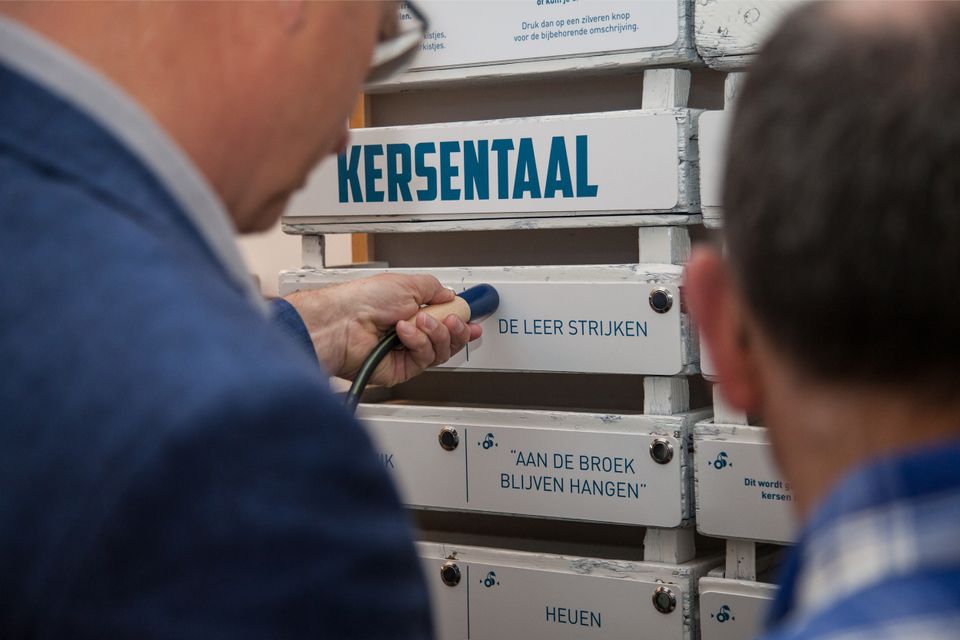
Kersenmuseum (cherry museum)
Cherry growing plays an important role in the heart of the Kromme Rijn region, and it is here you will find the Kersenmuseum (cherry museum) at Theo and Martine Vernooy's fruit farm.


Kersenmuseum (cherry museum)
Cherry growing plays an important role in the heart of the Kromme Rijn region, and it is here you will find the Kersenmuseum (cherry museum) at Theo and Martine Vernooy's fruit farm.
Visitors to this interactive museum will learn about the rich history of cherry growing, with attention to aspects such as tradition, pride, culture, great stories, nostalgia and unity. Although we are talking about a centuries-old tradition, cherry growing is very much evolving as age-old expertise is combined with modern-day technology.

End point:
TOP Stadshaven Wijk bij DuurstedeHavenweg 1
3961 MA Wijk bij Duurstede
Navigate to endpoint
- 15
- 14
- 55
- 53
- 46
- 54
- 52
- 77
- 51
- 18
- 14
- 26
- 64
- 82
- 47
- 66
- 63
- 58
- 57
- 30
- 56
- 50
- 13
- 14
- 15
Attributes