odp
121 to 144 of 302 locations
-
Fort Hoofdijk
Fort Hoofdijk
3584 HD Utrecht -
Fort Maarsseveen
Fort Maarsseveen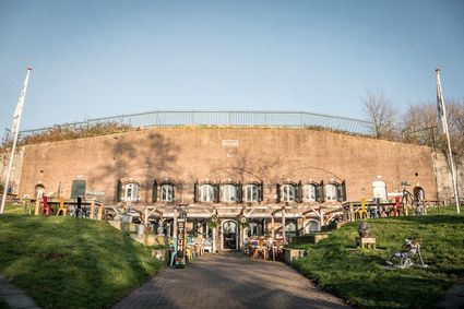
3602 AM Maarssen -
Cheese Warehouse | Cheese Experience
Cheese Warehouse | Cheese Experience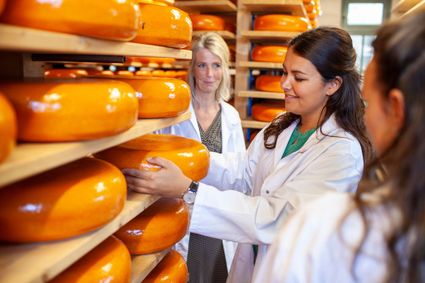
Emmakade 6A
3441 AJ Woerden -
Rope museum
Rope museum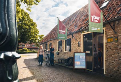
3421 SZ Oudewater -
Koppelpoort Amersfoort
Koppelpoort Amersfoort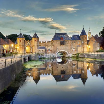
3811 MG Amersfoort -
Fort 't Hemeltje
Fort 't Hemeltje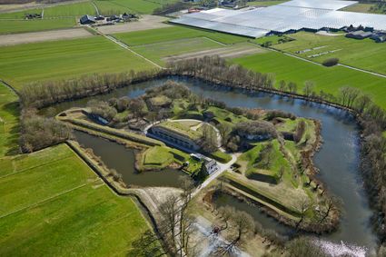
3992 LX Houten -
Ledig Erf
Ledig Erf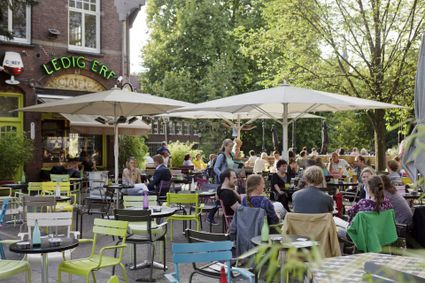
Tolsteegbrug 3
3511 ZN Utrecht -
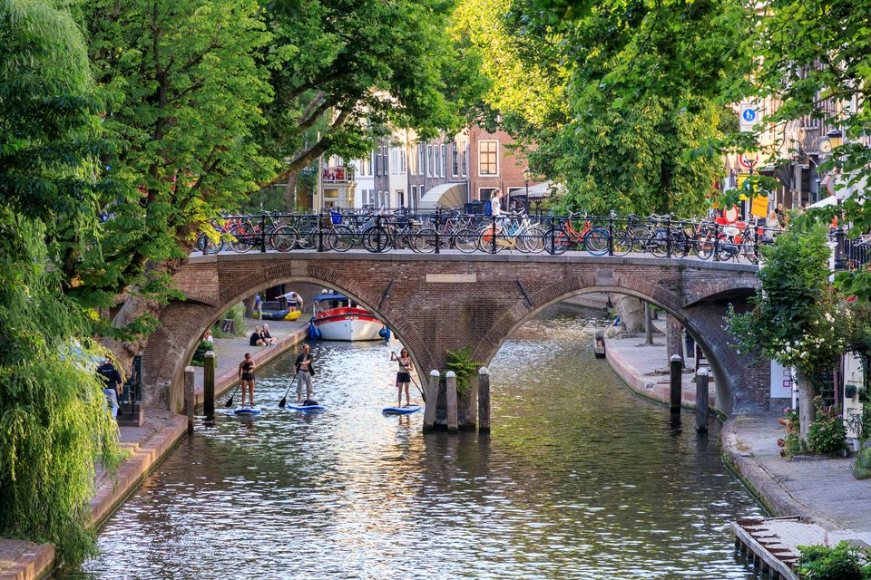
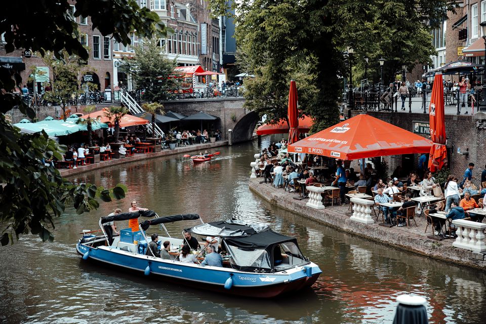
Canals and shipyards
Canals and shipyards
The Utrecht canals with their wharves and wharf cellars are unique in the world.
The 12th Century Oudegracht was built to change the course of the Oude Rijn river. Connecting the river Vecht in the north to the Vaartsche Rijn in the south, the Oudegracht was destined to become an elongated harbour. Large city castles were built along the canal and in the 13th Century, shipyards were built as second streets at water level. The deep cellars, serving as storage spaces, ran through to below the houses. Today, the canals and shipyards are home to shops, restaurants and private residences.
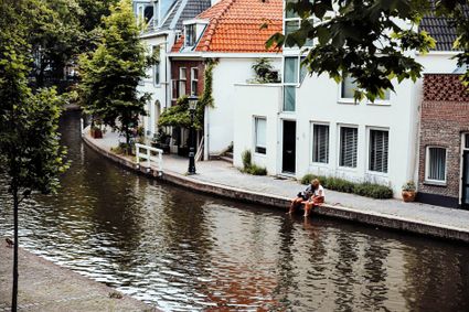
3511 AZ Utrecht -
-
Leersumse Veld
Leersumse Veld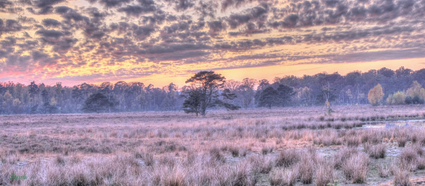
3956 KW LEERSUM -
VVV agentschap Breukelen
VVV agentschap Breukelen
Herenstraat 4
3621 AR Breukelen -
Vianen Municipal Museum
Vianen Municipal Museum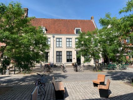
Voorstraat 97
4132 AP Vianen -
Fort Uithoorn
Fort Uithoorn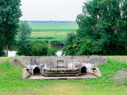
1427 AV Amstelhoek -
Camping De Grebbelinie
Camping De Grebbelinie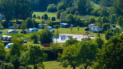
3927 CJ Renswoude -
Peking Garden
Peking Garden
-
Werk aan de Waalse Wetering
Werk aan de Waalse Wetering
This defence work was built in 1875–1878 and comprises a bomb-proof outbuilding and a guardhouse.
In emergencies, it could harbour as many as 95 men.
The fort is freely accessible and boasts uninterrupted views of the island of Schalkwijk. The Verdronken Bos (drowned forest), where a wooden walkway takes you across the water, is a short walk away.
3999 NS Tull en 't Waal -
-
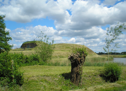
Fort at 't Hemeltje
Fort at 't Hemeltje
Fort 't Hemeltje dates from 1877-1881 and is the last built fort of the New Dutch Waterline. It defended a strip of land that could not be flooded and the 's-Hertogenbosch-Utrecht railway line. Nowadays, Fort bij 't Hemeltje is largely used as office space for various entrepreneurs who are active in the field of sustainability. The fort also offers shelter to (breeding) birds and bats.
There is a walking route around the fort and there is an exciting spy route with fun assignments for children. In addition, the fort is regularly open to the public, for example during Open Heritage Days.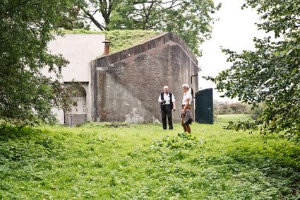
3992 LX Houten -
-
Restaurant De Dennen
Restaurant De Dennen
3927 AW Renswoude -
Wiel van Bassa
Wiel van Bassa
Diefdijk -
Centraal Museum
Centraal Museum
The Centraal Museum is your gateway to art and culture from the world of Utrecht. From Rietveld to the Utrecht Caravaggists, from Dick Bruna to Moesman and from Viktor & Rolf to the centuries-old Utrecht ship. A museum which leaves you inspired time after time. The museum has been housed in this medieval cloister on the Nicolaaskerkhof since 1921 and currently consists of an eclectic collection of buildings with a large courtyard at their centre. It’s a lovely place to wander through hallways and stairwells, and where you can be surprised by the various exhibitions.
Collection
The museum has the largest collection of Rietveld pieces in the world, and shows the work of the world-famous Dick Bruna. The collection of old art is also worthwhile with work from Jan van Scorel, Abraham Bloemaert and Hendrick ten Brugghen. Besides the work of those Dutch icons, the Centraal Museum provides a broad overview of 2.000 years turbulent history, is also the ‘present’ a central theme with current fashion, design and visual art are high on the agenda.Studio Dick Bruna
A special part of the Central Museum is the studio of Dick Bruna, one of the Netherlands’ most famous illustrators and graphic designers. For the last 30 years of his career, he worked at his studio in the centre of Utrecht daily. This was where he created his illustrations and stories, surrounded by personal memories, photos of memorable encounters, gifts from fans and letters from fellow artists.Online tickets
Skip the queue and order your tickets online. You will receive your ticket by email and showing it on your smartphone at the entrance of the museum is sufficient.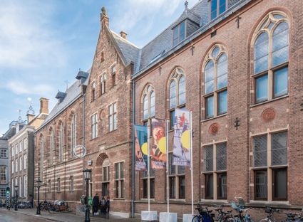
Agnietenstraat 1
3512 XA Utrecht -
-
TOP 't Hooge Erf
TOP 't Hooge Erf
3749 AB Lage Vuursche -
Recreatiepark De Lucht
Recreatiepark De Lucht
Barneveldsestraat 49
3927 CB Renswoude -
Amaliastein
Amaliastein
Daunstraat 26
4133 JE Vianen -
Goejanverwelle lock
Goejanverwelle lock
The Goejanverwelle lock and the Enkele Wiericke lock on the Hollandse Ijssel played a key role in the Disaster Year. Together with the lock at Nieuwerbrug on the Oude Rijn, they formed the inlet to the Langeweide polder, which was the narrowest section of the Waterline. The locks were opened on 17 June 1672 – just in time to halt the advance of the French, who had already captured Oudewater and marched right up to the edge of the hastily flooded Waterline. With great promptitude, the commander of the garrison at Goejanverwelle, the Count of Horn, gave the order to raise sconces and fortifications to defend the locks. For the moment, the Waterline was safe!
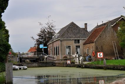
3467 PR Hekendorp -
-
Pannenkoekenhuis Bergzicht
Pannenkoekenhuis Bergzicht
3931 MH Woudenberg